Purpose
- Investigates the effect of the global financial system and/or the monetary system in fostering a sustainable economy.
- Explores and develops market-based solutions.
Summary
This project aims to gather remaining information necessary to implement the creation of successful biological corridors between the Children’s Eternal Rainforest, at the heart of the protected Monteverde-Arenal Bioregion, and vital conservation lands more distantly located. We will accomplish this by mapping land ownership, current conservation efforts, and likely future land-use changes within two potential biological corridors. We will develop a long-term plan to protect and enhance the corridors, most likely involving consultation and advisement with landowners and direct purchase of select properties. This effort will contribute to meaningful ecological connections to land that has been successfully protected thus far, helping ensure long-term conservation of forests, biodiversity and ecosystem services. This work will continue to support and enhance the economic well-being, human health, and community strength that has been created in this region through conservation.
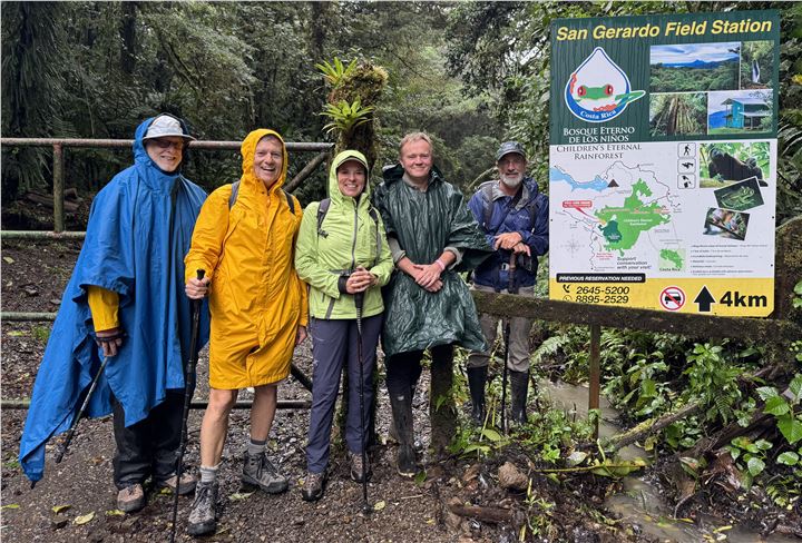
Foundation site visit to Monteverde, Children's Eternal Rainforest and proposed corridors.
Description
The original proposed timeline for this project was June 1, 2025 to May 31, 2027. Due to a series of unexpected events in the organization (unrelated to this grant), we have adjusted the timeline to begin in January 2026. The new overall timeline will run from January 2026 to December 2027.
We are currently in the process of contracting the GIS specialist to begin the first phase of land ownership maps. Related to the overarching goals of this project, the Monteverde Conservation League has recently helped to found the Monteverde Conservation Collective, an alliance between the Monteverde Conservation Association, the Monteverde Institute, and the Costa Rican Conservation Foundation. The Collective was formed in 2024 to support conservation in the Monteverde area through informed planning, promotion of a conservation easement model, and cultivation of a next generation of local leaders. The Collective's work expands each organization's efforts in a) habitat protection and restoration, b) facilitating landscape connectivity, and c) supporting and implementing community and educational initiatives to increase the region's well-being. As a collective, each conservation action represents a joint effort among the organizations, thus providing greater collaboration, goal achievement, and long-term commitment.
March 8, 2026 update:
Stage 1: Determine the land ownership patterns within each corridor and create appropriate maps. We have contracted Doris Rojas, GIS specialist, to begin the first phase of land ownership maps.
Stage 2: Determine land-use patterns and plans within each corridor. Dr. Matthew Moran is working with intern Sasha Nieman on beginning land use analysis and planning for basic biodiversity surveys.
July 6, 2026 update:
Conclusions after Stage 1, Part I:
A comprehensive geospatial database integrating cadastral and property registry information for the properties located within the proposed biological corridor was successfully developed. The identification of 165 properties provides a robust technical foundation for supporting land-use planning and biodiversity conservation initiatives. Registered properties covered 52% of the study area. 48% of the study area did not have registered property plans. The integration of spatial information with property registry data facilitates informed decision-making and serves as a valuable tool for prioritizing future conservation and ecological restoration efforts. Furthermore, the project highlights the importance of maintaining up-to-date cadastral and property registry information to ensure the reliability of future land-use analyses.
Stage 1, Part II: The next step is to determine the land ownership patterns and create appropriate maps for the corridor in the Tenorio region. Based on our initial investigations, the Tenorio Corridor appears to be more challenging in terms of online availability of property data. Costa Rica’s national registry also recently cancelled many cadastral maps for properties without legal title,
further complicating online access to data. This does not diminish the importance of either corridor and we are committed to continuing with this work.
Stage 2: Determine land-use patterns and plans within each corridor. Dr. Matthew Moran has been working with intern Sasha Nieman on beginning land use analysis and planning for basic biodiversity surveys.
Project timeline:
The project timeline continues to be from January 2026 to December 2027.
Refer to the attached project report for more detailed information.
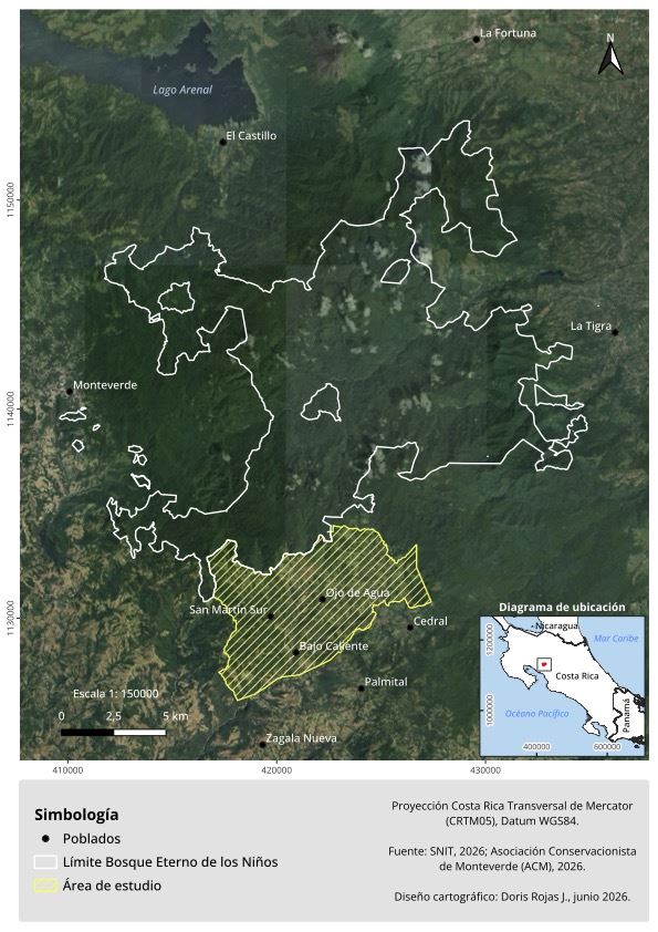
Map of Southern Study Area - Bellbird Corridor
Purpose
This project addresses biological corridors crucial for the conservation of the CER and the greater Monteverde Arenal Bioregion, one of the most important ecotourism locations in Costa Rica, vitally important for the regional economy. Tourism has both promoted and threatened biodiversity: increased tourism has caused isolation of protected lands from other natural landscapes, but ecotourism is entirely dependent on a healthy, biodiverse environment. Tourism has also created thousands of jobs, increasing local support for conservation. In this way, tourism brings not only a conflict, but also a possible economic and conservation solution focused on maximizing the region’s ecosystem services. If additional properties are developed for ecotourism, the region could expand the tourism sector, spreading benefits to a larger geographic area. For the biodiversity of the MAB to survive long-term, the corridors described in this grant must be enhanced and protected from long-term degradation.
Scope
This project addresses an important challenge of conservation and ecotourism development. The study area – the Monteverde Arenal Bioregion, with the CER at its center – is home to a vibrant tourism economy, which in turn depends on a healthy and biodiverse environment. Paradoxically, tourism, even with the best of intentions, can cause land-use changes, habitat fragmentation, and ultimately ecosystem degradation and species loss. This project seeks solutions to protect and enhance biodiversity and ecosystem services in a region critical for global biodiversity protection, and at the same time support the development and sustainability of a valuable ecotourism economy. There will be a focus on a market-based approach where we hope to encourage protection and enhancement of landscapes that provide the most ecosystem services promoting human health, well-being, and economic vitality. In short, we believe this region has landscapes whose greatest market value is as conservation properties.
Amount Approved$43,000.00
on 5/16/2025
(Check sent: 5/29/2015)
Proposed corridors from 2023 article "Establishing priorities for future land conservation to maximise biodiversity conservation and other ecosystem services in the Tilarán Mountains of Costa Rica" in Nature Conservation, by Lindsay Stallcup, Matthew D. Moran, Doris Rojas, Erich Mata.